Continent Map Set
A set of seven large format durable continent maps for use in classroom. The detailed continent maps show national boundaries and geographical grids.
The map is printed on a plastic sheet that is very durable and can withstand increased stress, so children can walk on the maps. The map includes buttons for hanging. If the map gets dirty, just wipe with a damp cloth.
The set of continent maps includes:
- a giant map of Europe measuring 150 x 120 cm at a scale of 1:5,000,000.
- a giant map of Australia and Oceania measuring 155 x 145 cm and at a scale of 1:4,000,000.
- a giant map of South America measuring 115 x 160 cm at a scale of 1:5 000 000.
- a giant map of North America measuring 155 x 173 cm and scaled 1:5 000 000.
- a giant map of Asia measuring 155 x 173 cm and scaled 1:6 000 000.
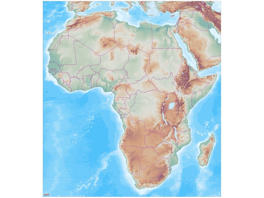
- a giant map of Africa measuring 150 x 170 cm and scaled 1:5 000 000.
- a giant map of Antarctica measuring 140 x 140 cm and scaled 1:4 000 000.
Maps are suitable for group and individual work of children. The set is 20% cheaper than buying each map separately.

Children use the maps as a basis for presentations, reports and key lessons.

Make your work easier with the worksheet tools we've created and offer for free download.
| Category: | e-shop |
|---|---|
| ? materiál: | 100 % PES |
| Počet hlavních vrstev: | 6 ks |


The maps are unlabelled and are suitable for group work in the classroom and as a basis for presentations, reports and key lessons. After use, children simply roll it up or hang it on the wall.


Be the first who will post an article to this item!
Add a rating