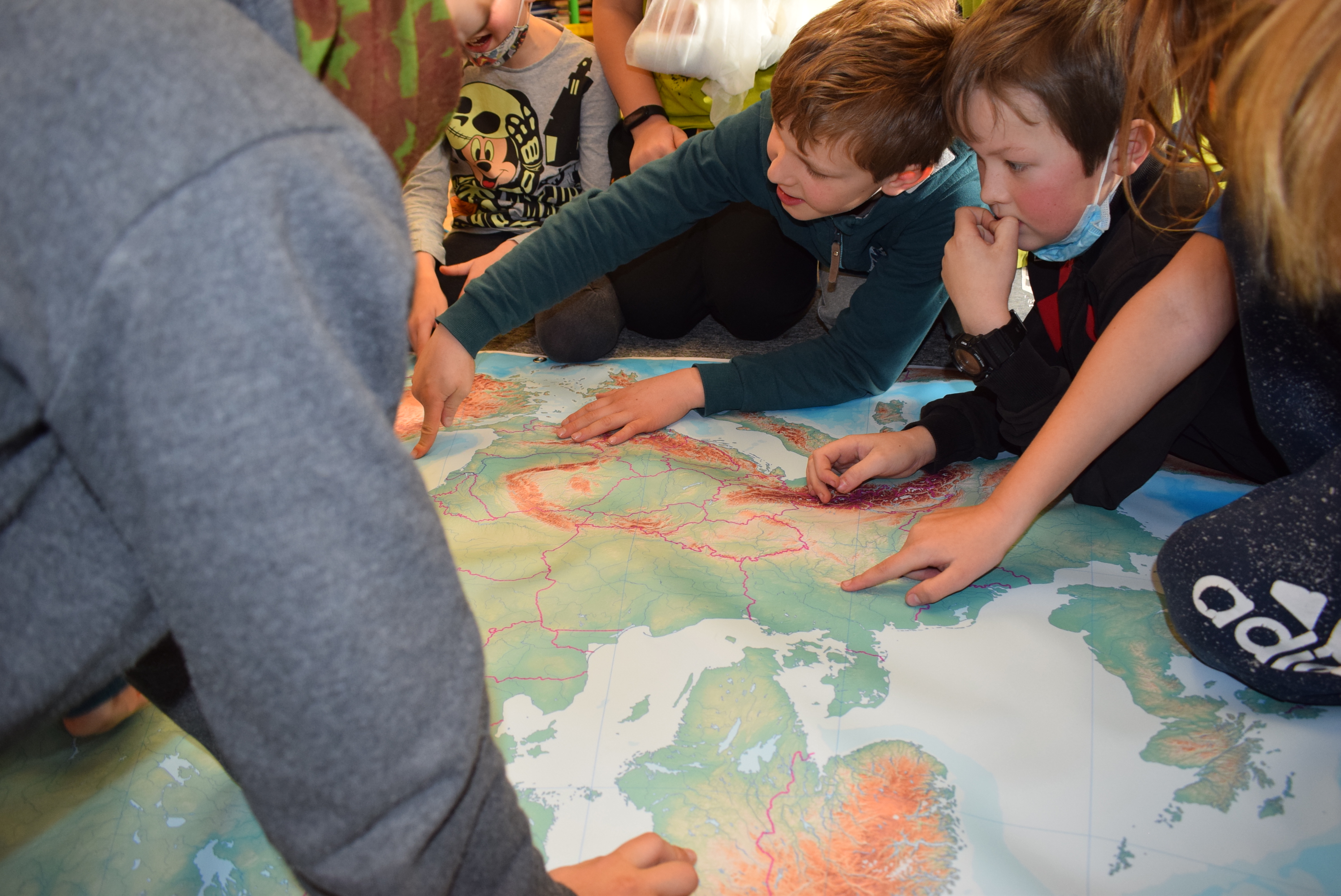
Download the worksheets for your children's classroom, which are suitable for children in the second and third three years of Montessori, roughly from grade 4 through grade 2. Explore the incredible heights of the European mountains. Stroke the snow-capped peaks of the giants. The European Mountai...
download
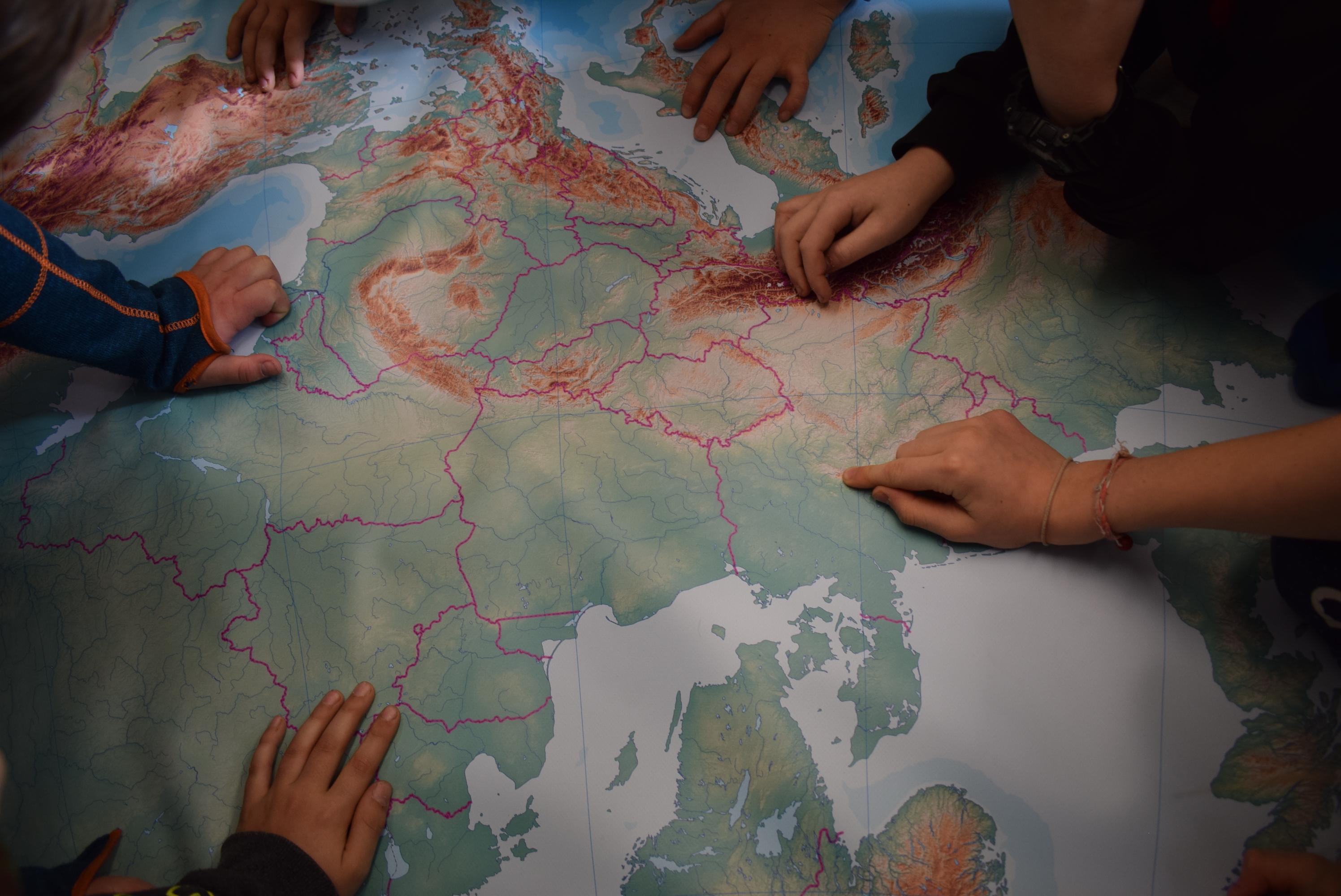
Blind map of the mountains of Europe
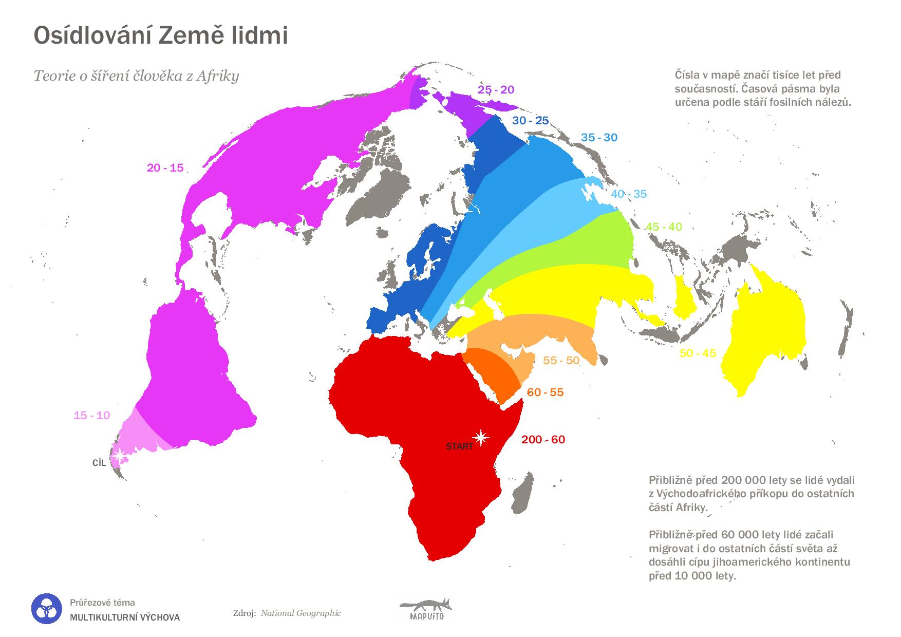
Map of human settlement of the Earth
According to the theory of human dispersal out of Africa, about 200,000 years ago, humans made their way from the East African Rift to other parts of Africa. Approximately 60,000 years ago, humans began to migrate to other parts of the world until they reached the tip of the South American ...
.jpg)
I love you in world languages
What words will you hear under the cherry trees of the world? In every part of the country, love is expressed in different words, and it is remarkable how similar some of the words are. A simple matching activity for children. Children place the hearts on a world map. DOWNLOAD AND PRINT THE HEARTS ...
.jpg)
Map of world currencies
The worksheet is suitable for work with children in the second three years or in the first stage of primary school. The map of world currencies was created for you by Ondra from MAPUITO. The worksheet can also be accompanied by a large world map produced by a small family-run company MAPUITO. &nb...

The largest islands in the world
We are learning and searching for the largest islands on Earth. We offer you free downloadable bonus cards for working with the world map. The tool contains two sheets of paper on which you will find eleven cards to print. One edge of each card has a place to cut out an arrow, which you can then ...
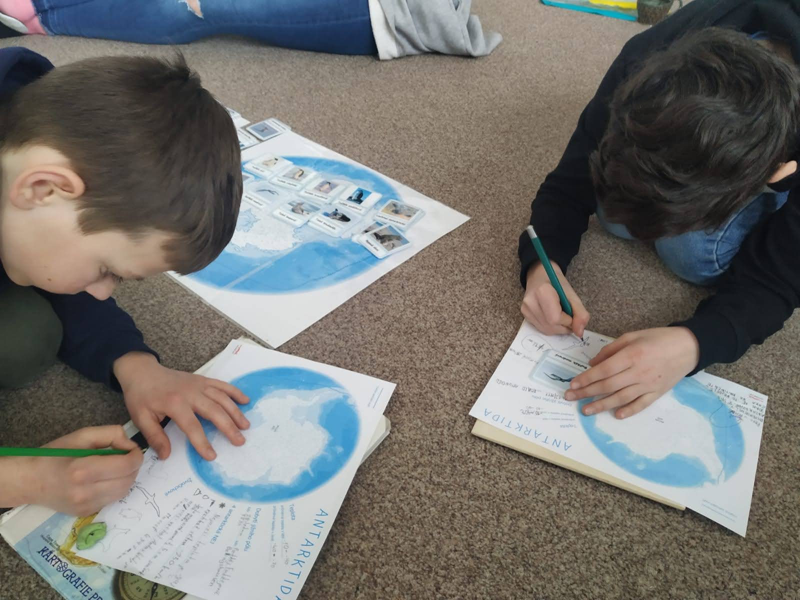
Polar Regions Download
We are sharing worksheets from the Geography Teacher Pack. You can also sign up your school to receive regular free downloadable geography worksheets. Download Antarctica Download Arctic Get Mapuito geography resources for your classroom and support a small family business. Have a nice day.Zuzk...

World river maps for download
Another tool that was supposed to be part of the Geography Teacher's Pack is worksheets that will help children learn more about the six rivers of the world. There was not yet the capacity to produce more worksheets. If you are missing a river, write to us and we can make it. So let the worksh...
Blind political map of Europe with capitals and flags to colour in
The project is suitable for first and second Montessori three-year olds, or for first grade children. Download a map of countries, their capitals and flags here: Map of European countries and their flags to colour For this activity, you need to work with an atlas, according to which the c...

Getting to know active volcanoes
Classroom activity tips: The children sit in a circle around a large map of the world on which volcanoes are randomly placed. The teacher leads the initial motivation to learn about active volcanoes: "What do you think, are the volcanoes correctly placed on the map?". According to the as...
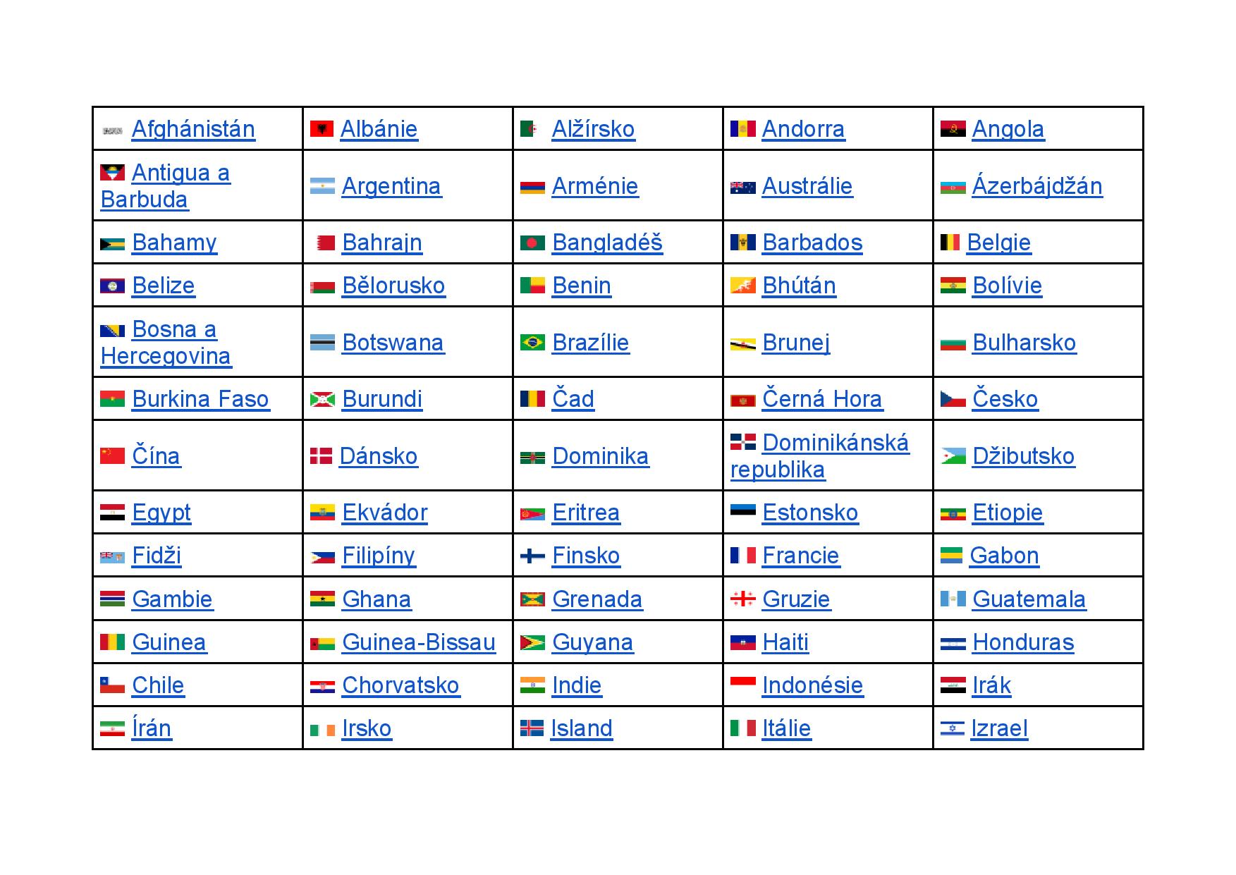
Sovereign states of the world
Help for the World Map. Many thanks to Mrs. Mgr. Miroslava Paličková from Křišt'ál Primary School, who made the cards and made them available for download. Do you also have interesting cards for the world map? Send them to us. Thank you in advance for enriching the teaching community! Thi...
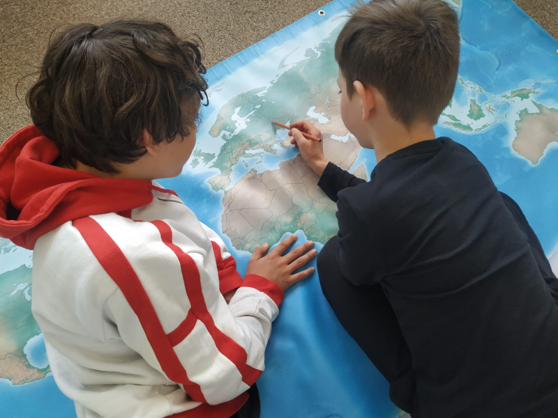
Human settlements
Activity:The children chose the optimal geographical location to build their settlement on a world map and then designed their own settlement according to their preferences, which they compared with each other - from this activity we got the types, features and functions of settlements, the distribu...
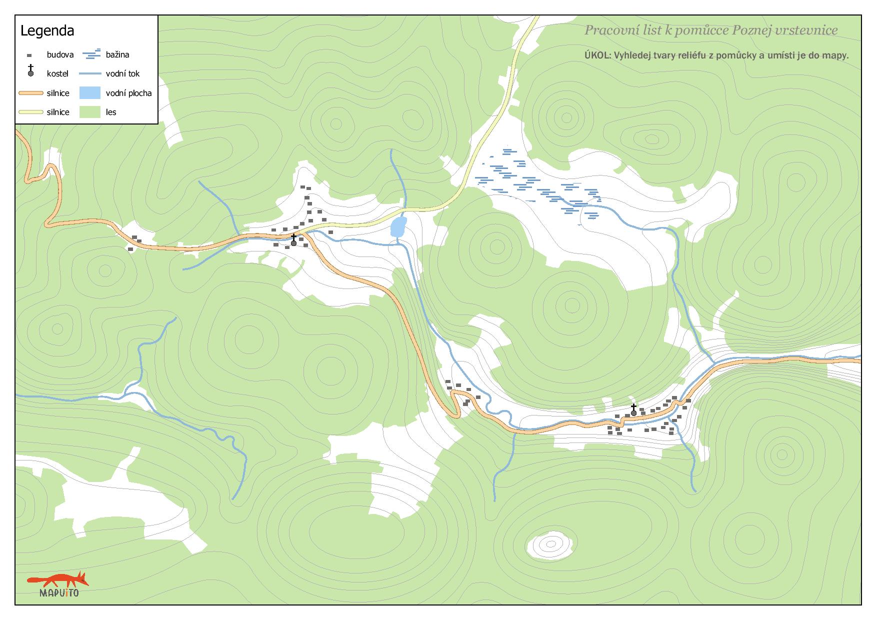
Know the contours - worksheets
We have created worksheets to help children learn to navigate on a map. The worksheets can be used on their own or as a supplement to the tool 3D contour tool. We offer you two worksheets to print on A4 together and two checklists. It is possible to add shapes cut out from the checklist to the map i...
12 items total