Czech Republic sightseeing set
A tool for the first and second three years, or for children in the first grade. Children search where rivers, mountains and cities are located and learn lots of interesting facts about them.
With an erasable marker, children mark places on a laminated map of the Czech Republic and on a 3D map.
Thanks to the wooden stands, children always have the tool within reach.
The set is suitable for group work on a large map of the Czech Republic.
The set was made in cooperation with Montessori teacher Eva Glabazňová from Monted.
| Category: | e-shop |
|---|---|
| Pro jak staré děti: | první a druhé trojročí, nebo první stupeň |
| Co od nás dostanete: | mapu, kartičky, stojánky, popisovač |
| Materiál kartiček: | trvanlivý matný laminovaný papír |
| Kontrola chyby: | ANO |
| Skupinová práce: | ANO |
| Samostatná práce: | ANO |


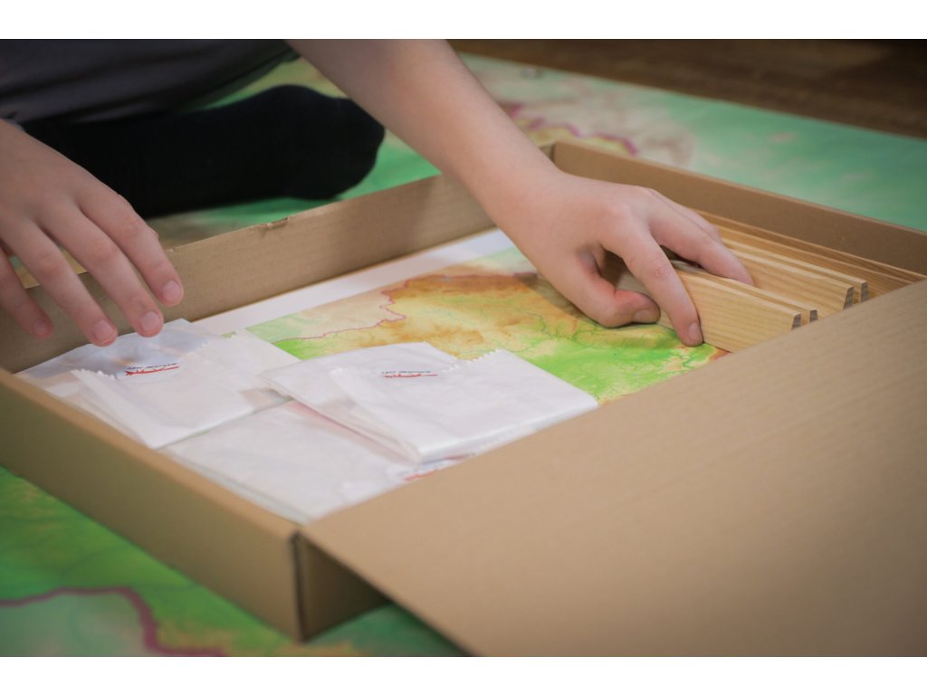

What exactly does the kit contain?
A set of three Exploring Czech rivers, towns and mountains aids printed and reinforced with hard matt laminate.
There are 90 cards in total!
45 cards with descriptions of mountains, rivers and towns measuring 12 x 5 cm
22 smaller cards measuring 5 x 4 cm
23 cards measuring 2 x 11,5 cm
A 3D printed plastic map of the Czech Republic, 18 x 10,5 cm.
Describable Montessori map of the Czech Republic A3 size laminated
Pilot V-BOARD MASTER ULTRA FINE S black marker with replaceable refill, which is environmentally friendly
Three ash wood easels made by a local woodworker. The stands are painted with osmo oil and certified suitable for children (two wooden stands are 19 x 3 cm, one is 24 x 3 cm)
Why buy maps from MAPUiTO?
The maps excel in display quality, you can see even the smallest details and underwater relief on them.
We produce large and durable maps that children can walk, run, work independently or in a group.
Connecting geography and learning. The maps are produced by a Montessori teacher and a physical geographer with many years of experience in geoinformatics systems.
New tools are invented together with teachers.
Lots of free supplementary materials. We create free supplementary worksheets for the maps. You can also look forward to 3D aids.
Family production for us means maximum commitment to you and attention to your requirements. We produce customized maps.
We care about the environment. Every month we plant a tree in cooperation with Arnika. We try to avoid unnecessary plastics in packaging and use paper adhesive tapes. We print all maps in the Czech Republic. We are always looking for more environmentally friendly ways to print maps and the material meets the Reach Directive.


Mapy v akci
 Lenka
Lenka