3-Part Montessori Cards landforms
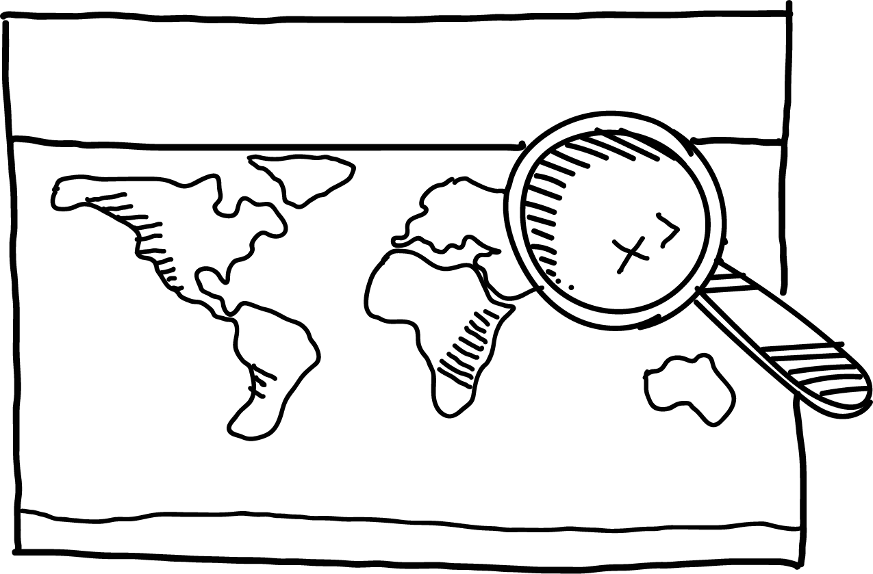
Three-fold cards with land and water shapes are perfect for working with a large world map. For each land shape, the cards include an example and its location on the world map.
The tool includes a picture card, a text card, and a control card that puts the text and picture together. The landforms are placed on a yellow or blue background, increasing the child's attention span and helping them to focus on a particular shape. Children place the aids in a wooden stand so they are always close at hand.
The set contains nine landforms worked into 27 cards: 9 large (9x8 cm), 9 smaller (5x9 cm) and 9 smallest (3x9 cm) cards.
How to use the cards in the classroom: The child connects the pictures with the text cards and, based on the clues, looks for a specific landform on the map. The child checks the work with a third card that contains both the picture and the text.
| Category: | e-shop |
|---|---|
| Příklady na mapě světa: | ano |
| Materiál, ze kterého jsou vyrobené kartičky: | matný laminovaný papír |
| Kontrola správnosti: | ano |
| Dřevěný stojan: | ano |
| Počet kartiček: | 27 |
| Kartičky 9x8 cm: | 9 |
| Kartičky 5 x 9 cm: | 9 |
| Kartičky 3x9 cm: | 9 |


Why get maps from MAPUiTO?
The maps excel in display quality, you can see even the smallest details and underwater relief.
We produce large and durable maps that children can walk, run, work independently or in a group.
Connecting geography and learning. The maps are produced by a Montessori teacher and a physical geographer with many years of experience in geoinformatics systems.
New tools are invented together with teachers.
Lots of free supplementary materials. We create free supplementary worksheets for the maps. You can also look forward to 3D aids.
Family production for us means maximum commitment to you and attention to your requirements. We produce customized maps.
We care about the environment. Every month we plant a tree in cooperation with Arnika. We try to avoid unnecessary plastics in packaging and use paper adhesive tapes. We print all maps in the Czech Republic. We are always looking for more environmentally friendly ways to print maps and the material meets the Reach Directive.


, 9 smaller (5x9 cm) and 9 smallest (3x9 cm) cards. <br />How to use the cards in the classroom: The child connects the pictures with the text cards and, based on the clues, looks for a specific landform on the map. The child checks the work with a third card that contains both the picture and the text.</span><span style="font-family: arial, helvetica, sans-serif; font-size: 12pt;"></span></h3>)